I have a BRB 70cm GPS connected to an android tablet with APRSDroid via Moblinkd TNC.
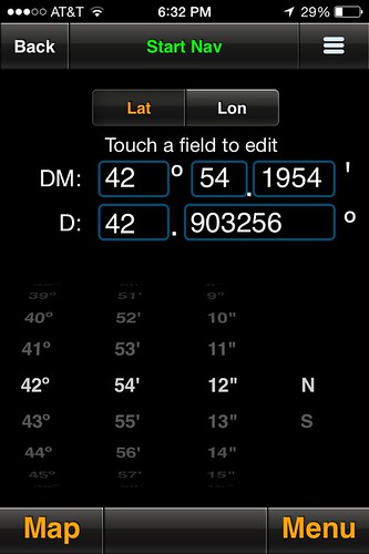
I would like to type the coordinates from APRSDroid into my Iphone and have it guide me to my rocket using the phone's built in GPS. I think APRSDroid gives decimal degrees.
Has anyone found an Iphone app that does this well? I don't really need anything other than what direction to walk and how far.
Thanks!
Brian
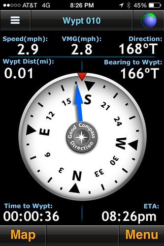
") ). I've used it at least a dozen times so far when tracking rockets, always worked great. I've sometimes forgotten to stop navigating once I've recovered the rocket, which does help drain the phone battery faster. It's also handy for finding the launch site when out on the playa at Black Rock.
). I've used it at least a dozen times so far when tracking rockets, always worked great. I've sometimes forgotten to stop navigating once I've recovered the rocket, which does help drain the phone battery faster. It's also handy for finding the launch site when out on the playa at Black Rock.