I've driven 163 a few times, usually I'm driving highway 95 in that area. I've been to Utah a whole lot of times and never been through Monument Valley so someday I should spend more time down there. I went through Blanding a couple of weeks ago driving highway 95 but that time I crossed Comb Ridge on the old dugway road, Posey's Trail, that's a little north of highway 95. It was very rough and I needed more ground clearance.
A couple of years ago we drove through there going east. 95 was closed east of 261 for some reason so they were diverting all traffic to go south on 261. I've done that road before but it was a long time ago. I didn't have any paper maps with me, there is no cellphone coverage down there, and the maps I downloaded to GAIA didn't cover that far south. We managed to make the right turns and go through Teec Nos Pos on our way to Shiprock.
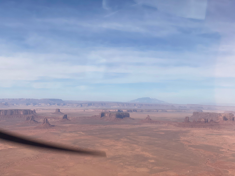
I think you would like Monument Valley. It's touristy as far as lodging and all that goes. If you go in the off season it's not too bad. I don't mind the vendors. I like talking with them actually. I haven't been there in a decade or more. I lived in Farmington for 5 years (home 2 years ago) and I didn't travel by ground much (which pisses me off because I've routinely driven over 1,000 miles to get there for a week of exploring. I didn't spend much time exploring at all after the first year that I lived there. Now I'm jonesing to go back).
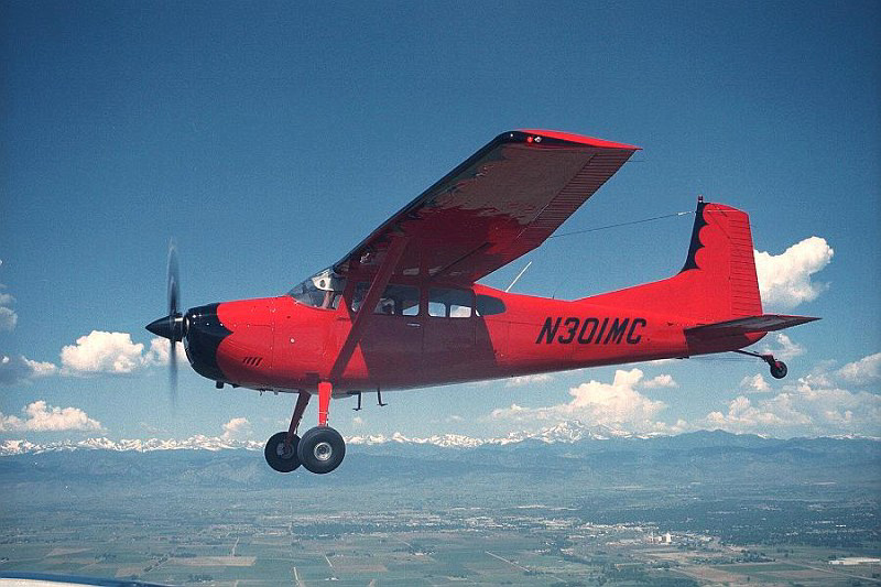
I did go to Chaco Canyon a few times, the Hovenweep complex, Nogales Ruin, some Chaco outliers, and some Navajo Pueblito's while I was there. I've flown down the Chuska's, landed at Gallup, taken off and flew west through the pass, then turned up the west side of the Chuska's, flew back north, and cut through the lower terrain at Red Valley, past Shiprock, and back to Farmington a few times. There's more to see traveling on the ground...
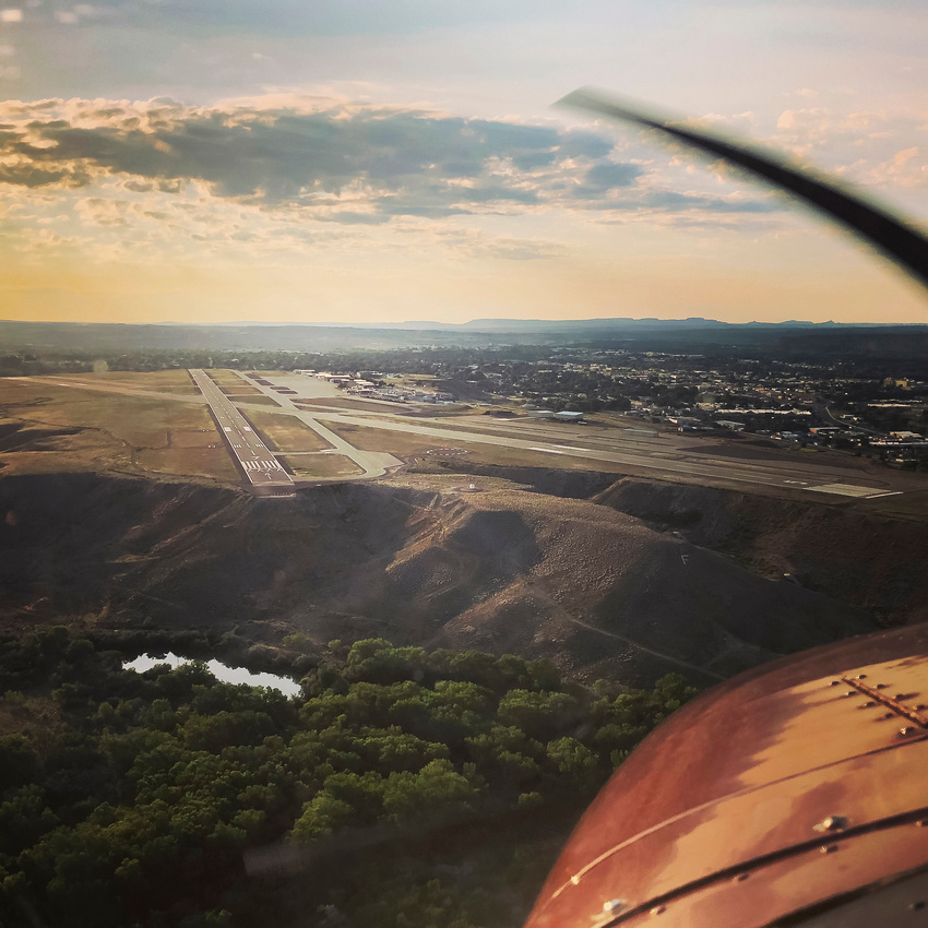
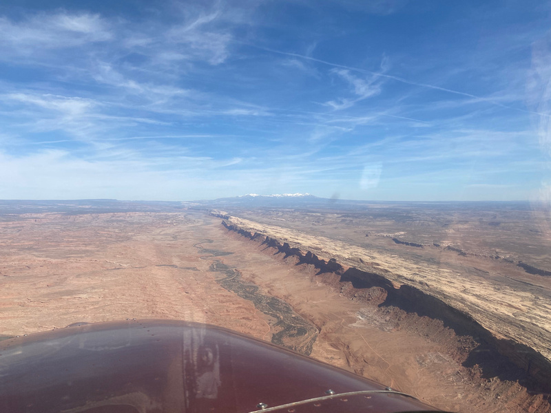
Blanding was my first choice of airports to fly to when I got checked out to fly by myself up there. The photo of Comb Ridge was from that flight. Why Blanding? Isn't it every pilots dream to announce over Unicom that they are "landing at Blanding"?

No... no it isn't... but that's my sense of humor.
I have a 2000 Land Cruiser, OME lift, tires, etc. The next time I'm up that way I'm going to have to check out Posey's Trail, when it's dry. I may have already driven it but it's not ringing a bell. The dirt "roads" in that part of the world get slick when they get wet and my LC, while capable, doesn't like mud.
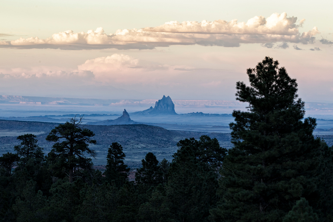
Have you driven from Red Valley over the Chuska Mountains to Lukachukai, Tsaile, etc? Indian Road Service Road 13 is south of Shiprock off 491. You get a great view of Shiprock from Road 13. So good that I don't have a photo online that I can share for some reason :/
and up in the Chuska's.
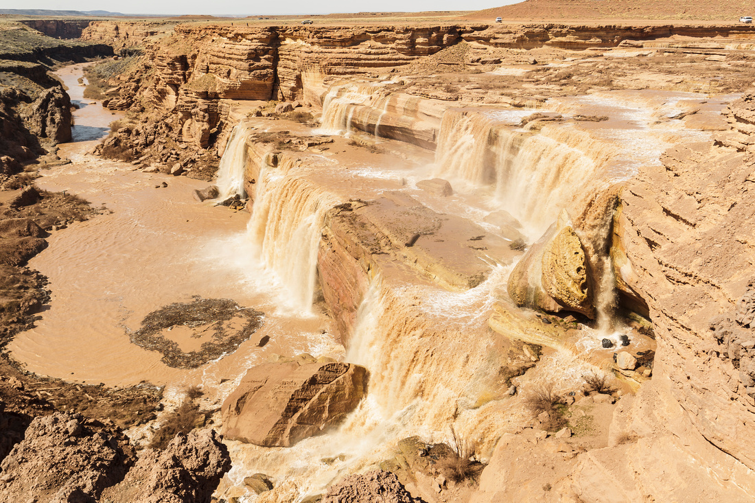
Switching locations, have you made it to Grand Falls when it was "falling"? It's cool. I was told that the vertical drop at Grand Falls is higher than Niagra Falls. I didn't measure it
Imagine all of that water being gone. That's what it normally looks like (dry as a bone). It's on Google Earth. NE of Flagstaff, AZ and N of Canyon Diablo, AZ.


.JPG")
.JPG")
.JPG")
.JPG")
.JPG")

.JPG")
.JPG")
.JPG")
.JPG")


.JPG")
.JPG")


.JPG")
.JPG")