Today the Featherweight Tracking System had a successful test in its first high-powered flight, so here's a little more info.
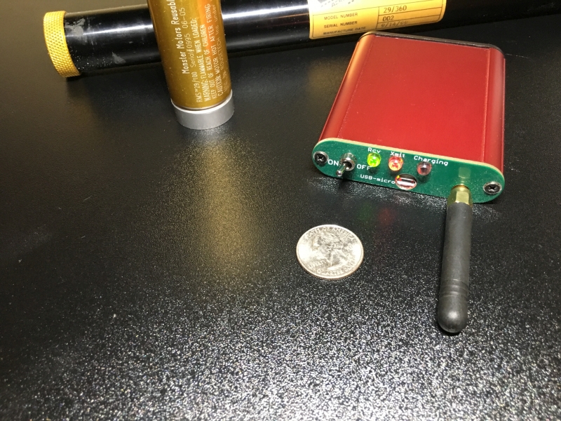
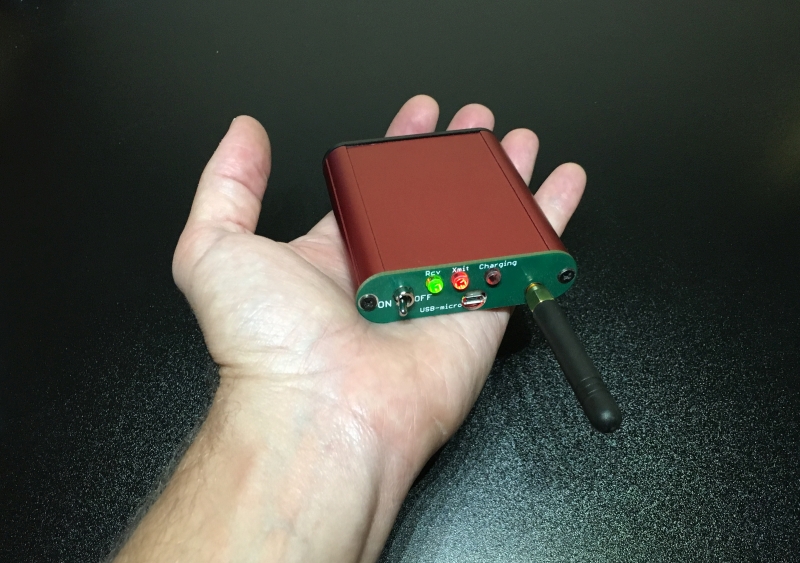
I don't have a good photo of the tracker itself, but I'll post one after I assemble one without the extra debug header pins. The dimensions of the production tracker board will be about 0.82" x 1.62". So it's a little smaller board than a Raven altimeter in both dimensions, despite having mounting holes for 4-40 screws. The 900 MHz stub antenna adds about 2.5" to the length if you mount it right to the board.
The tracker collects GPS data with a brand-new 8th-generation uBlox receiver that can receive data from both GPS and Russian GLONASS satellites at the same time, and integrate data from both constellations into its solution. The benefit is that for a given antenna field of view, twice as many satellites are available as for any GPS-only receiver. The testing I have done so far with this receiver has blown me away with how clean and accurate the data is, even in altitude and vertical velocity, which have been not-so-great with other GPS receivers I'm used to. I'm currently having it produce and record 10 GPS solutions per second, and in a test case where I pick the receiver off the ground and wave it around, you can clearly see that in the altitude and velocity data. There's less than 1 ft/second of measurement noise in all 3 dimensions.
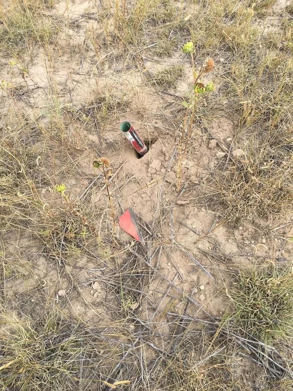
The tracker sends its data from the rocket down to the ground over a new protocol called LoRa (portmanteau of Long Range), which is a new commercial standard from Semtech optimized for sending small amounts of data over long range at very low power... in other words, tailor-made for rocketry GPS tracking. I'll post more details about the link performance later after I do some more range testing, particularly after BALLS next weekend where it will see some high-altitude flights.
To get this LoRa data into information you can use, there is a small ground station that fits in your shirt pocket, and relays the data to an app on your cell phone.
The micro-USB port is just for charging the battery (8-40 hours of life depending on battery size). The tracker sends out the data over Bluetooth Low Energy to an app on your phone.
We have been focusing on the iPhone app so far, since Android-compatible trackers already exist, but the plan is to make an Android version soon, too. During the flight, the app not only shows you the key information like altitude, vertical and horizontal speed and distance, but also has some real-time indicators that use the GPS, magnetometer and gyroscope in your phone so that you can use the phone to point right at the rocket. Kevin Small (author of the Featherweight Interface Program) has been working on the the app development, and came up with this. At first I was skeptical about how useful this would be, but when you try it and see the phone pointing right to where your rocket is in azimuth and elevation, it's pretty impressive. I'll show a screen shot once we get it a little farther along.
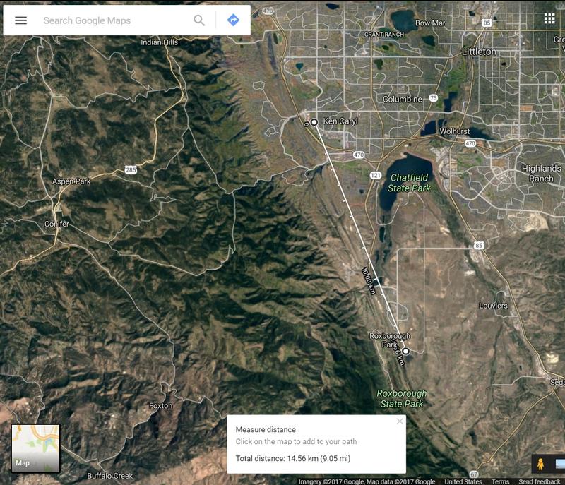
In today's test flight, I was trying to not only test the tracker and iPhone app (the first version of which I only downloaded last night!), but also to get re-certified L1 since my HPR certs have expired. Just about all of my HPR flights to date have been designed to be as high and fast as possible, so I decided to go big and use an AT I600 in a minimum-diameter 38mm rocket for my cert flight. Unfortunately, I neglected to ground test my deployment charges before the flight, and they were too small, so although the rocket had a sweet boost around Mach 1.3 up to 11,400 feet, it had a ballistic re-entry 1.2 miles up-wind. One of the features we're planning but have not yet implemented is data recording from the ground station. I did have 10 Hz data recording onto a micro-SD card on-board the rocket, but that's not so useful when a 4-foot long rocket's landing site looks like this:
Sorry, my rocketry skills are rusty. (Ground test, ground test, ground test!) My recollection from watching the phone display is that both the LoRa radio and the GPS kept lock throughout the flight, but confirming this impression will need to wait until next weekend's flights at BALLS. But what I can tell you is that the last packet that got to my phone was 6321 feet away from my phone, 448 feet above the ground, traveling -540 feet/second vertically and 52 feet/second horizontally. There was about 36 dB of radio link margin at this range and with these settings. When I hiked out to that latitude and longitude, sure enough the rocket tube was sticking out of the ground about 40 feet downrange of the last measurement report, just as you would expect from the horizontal velocity. So the last data point for tracking was right on the money.


")